Pinnacles National Park sits about 75 miles south of the San Francisco Bay Area in the Gabilan Range of west-central California, and yes, it is absolutely worth the drive.
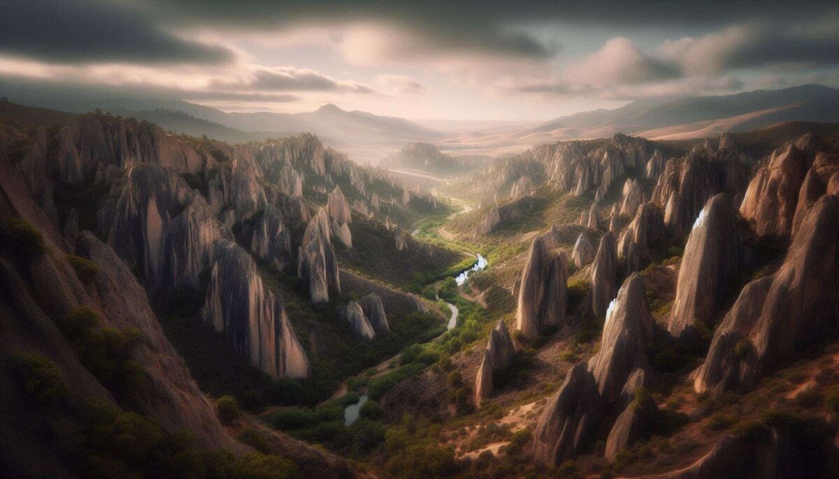
It is the state’s youngest national park, redesignated from a national monument in 2013, and it covers just over 26,000 acres of volcanic rock formations, talus caves, and chaparral-covered hills that feel nothing like the California most visitors imagine.
If you are trying to decide between Pinnacles and a more famous California park for a weekend trip, the case for Pinnacles is simple.
You can actually hike it without fighting for parking at 6 a.m., the caves are unlike anything else in the national park system, and there is a genuine chance of watching a California condor one of the rarest birds on earth soar directly overhead.
Getting there requires picking a side. The east and west entrances are not connected by road, only by trail, and they are at least an hour apart by car.
Most first-time visitors come through the east entrance, which has the only campground in the park, more visitor services, shade, and access to the iconic Bear Gulch area.
The west entrance, approached through a narrow road from Soledad, gives you access to the Balconies Cave system and the high rock walls on that side.
If you are planning a single day visit from San Jose, Monterey, or San Francisco, the east entrance is the practical choice.
How Long to Visit
One full day from the east entrance is enough to see the highlights: hike Bear Gulch Cave to the reservoir, then push up the Condor Gulch Trail to the High Peaks area if your legs have the votes.
That combination, around six miles total, covers the caves, the reservoir, and the dramatic spire terrain above, with a reasonable shot at a condor sighting.
Two days lets you add the west side and pace the hikes without racing the afternoon heat, which in summer can be genuinely punishing.
The Santa Lucia Mountains block the coastal breeze, and temperatures regularly push into triple digits from June through August. Come in spring or fall.
Spring is the crowd favorite for good reason. Wildflowers bloom across the hillsides in March and April, temperatures are mild, and the caves are more likely to be fully open.
The Bear Gulch Cave closes periodically throughout the year to protect a large colony of Townsend’s big-eared bats, a sensitive species that nests in the cave’s upper reaches.
Before you drive out, check the cave status on the official NPS park conditions page, it is updated regularly and will save you the disappointment of arriving with a flashlight and nowhere to use it.
The Bear Gulch Cave and Reservoir Loop
The Bear Gulch area is the essential Pinnacles experience, and the reason is the cave itself.
These are talus caves, formed not by water carving through limestone in the usual way but by enormous boulders stacking and wedging together over thousands of years of seismic activity along the nearby San Andreas Fault.
Walking through them means scrambling in near-darkness, crouching under massive rocks, and occasionally wading through a few inches of water depending on seasonal rainfall. Bring a flashlight the cave is pitch black in sections and wear shoes you do not mind getting wet.
Above the cave, the reservoir appears almost surreally calm against the surrounding rock formations. The Civilian Conservation Corps built the dam here in 1935, and the resulting pool has become habitat for the threatened California red-legged frog.
It is a good place to stop for lunch before deciding whether to continue up toward the High Peaks or loop back down the exposed Rim Trail.
The High Peaks Trail and the Condors
The full Condor Gulch to High Peaks loop runs around 5.6 miles from the Bear Gulch parking area and is genuinely strenuous in sections.
The trail climbs iron rung ladders bolted into the rock, navigates narrow ledges with sheer drop-offs, and rewards you with unobstructed views across the Gabilan Range.
The name is not aspirational. California condors with wingspans approaching ten feet actually nest in the High Peaks area and are frequently spotted riding thermals above the spires, especially in the early morning and late afternoon hours.
The condor program at Pinnacles is part of a broader recovery effort that began after the species was reduced to just 27 individuals in the 1980s.
Since 2003, the park has served as a release and monitoring site for captive-hatched birds. Seeing one in the air above you, close enough to make out the numbered tag on its wing, is one of those outdoor experiences that stays with you long after the trip.
Hikers with a fear of heights should evaluate the High Peaks Steep and Narrows section carefully before committing the exposure is real and the terrain is technical.
That said, the railings are solid, and most reasonably fit visitors who take it slowly do fine.
If you are building a California road trip that includes multiple parks, Pinnacles fits naturally into a central California circuit.
You can pair it with a coastal drive through Big Sur to the south or use it as a stop on the way down to Death Valley National Park, which is a full-day drive southeast.
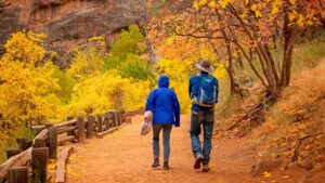
For those coming from the north who have already done Yosemite, our guide to photographing Yosemite covers the visual side of that park in depth if you are building a shooting itinerary through California.
The West Entrance and Balconies Cave
The Balconies Cave on the west side is the looser, more adventurous alternative to Bear Gulch. The scrambling is more physical, the lighting is more chaotic, and the route is less trafficked.
It hosts thirteen bat species, which is why the caves are subject to seasonal closures on this side as well.
The Balconies Cave Trail runs about 2.6 miles round trip with less severe elevation change than the High Peaks routes, making it a reasonable option for families with older children or hikers who want the cave experience without the cardiac climb.
The NPS alerts page is worth checking before you head to the west side specifically, as trail closures here tend to be less predictable than on the east.

Entry
Entry costs $35 per vehicle for a seven-day pass. The America the Beautiful annual interagency pass at $80 covers all federal lands and makes obvious financial sense for anyone visiting two or more national parks in a year, which is most people who are seriously planning a parks trip.
Pinnacles Campground on the east side has 134 sites across five loops, with tent and RV options. Reservations open six months in advance on recreation.gov and fill fast for spring and fall weekends. Most RV sites include electrical hookups.
Water is available at the campground and visitor center but not on trail.
This is not a park where you can underestimate hydration. The rock terrain amplifies heat and the exposed ridge sections provide no shade.
A liter per two miles is the floor, not the ceiling, and salty snacks matter on the longer hikes.
Wear trail shoes with grip rather than casual sneakers, because the High Peaks route involves enough uneven rock that ankle support genuinely counts.
Rock climbing is popular at Pinnacles and draws visitors from across California and beyond.
The park has one of the highest densities of prairie falcons in North America, which means the climbing community coexists with active raptor nesting sites and some areas are seasonally restricted.
Check with a ranger or the park website before planning a technical climbing trip, especially in spring when nesting is most active.
Pinnacles vs. other California Parks.
Pinnacles gets around 168,000 visitors a year. Yosemite gets roughly four million. That gap explains a lot about the Pinnacles experience.
You are unlikely to spend 45 minutes circling for parking, the trailheads do not feel like stadium concourses, and a midweek visit in spring can feel almost private.
What Pinnacles trades for that is scale and the kind of dramatic scenery that appears on magazine covers.
The park is compact, the drives inside it are short, and the landscape reads as strange rather than monumental. But the strangeness is exactly the point.
For visitors building a longer Southwest national parks loop that includes Utah, it is worth noting that Pinnacles shares some DNA with Utah’s canyon country in the way its geology dominates the experience.
If you are planning to follow up with stops in Utah, our posts on Bryce Canyon National Park and Zion National Park cover both in full detail.
Pinnacles does not reward passive visitors. The geology is not self-explanatory, the condors require patience, and the best hike in the park will push most people.
But California is full of parks where you can drive to a viewpoint and feel satisfied, and Pinnacles is not one of them.
It is the one where you crawl through a dark cave, pull yourself up a ladder bolted into volcanic rock, and watch a nearly extinct bird catch a thermal thirty feet overhead. The fact that most people have never heard of it is, at this point, its defining feature.