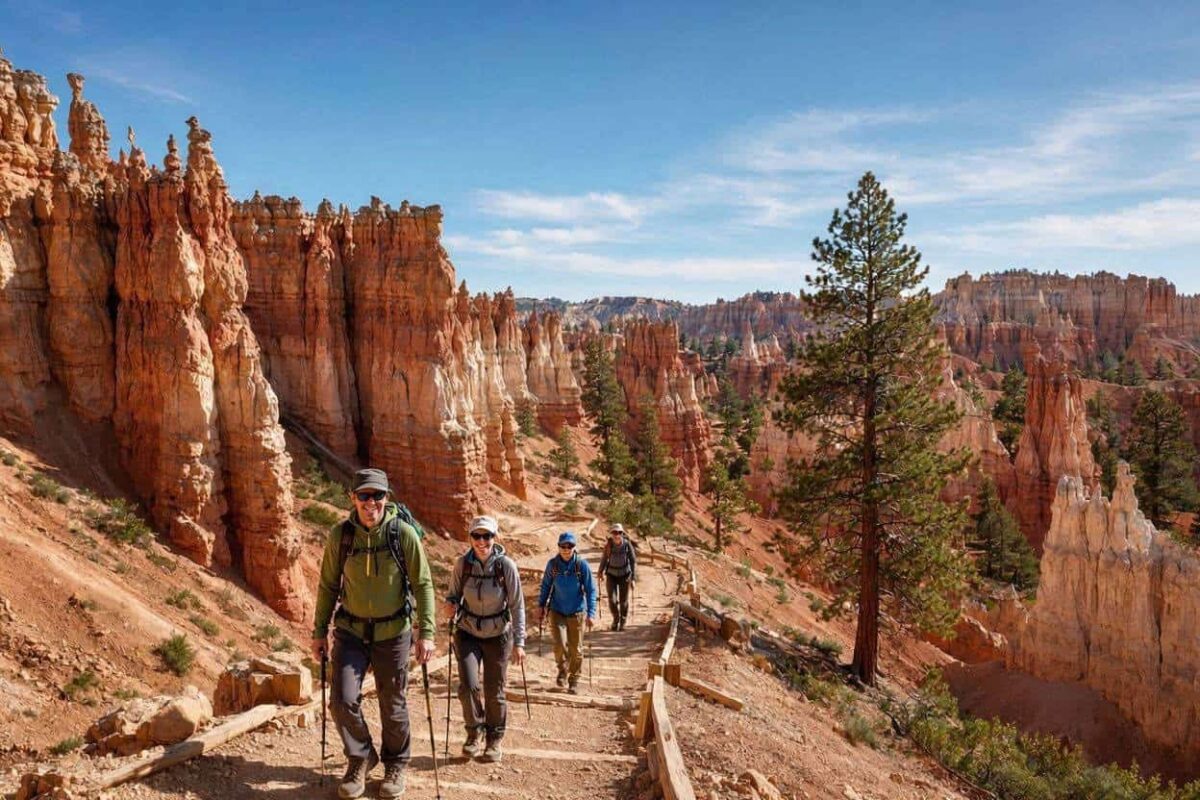
The best hikes in Bryce Canyon National Park sit inside one of the most visually extraordinary landscapes in the American Southwest.
Bryce Canyon stops most visitors in a way that other parks do not.
The hoodoos, those thin towers of red, orange, and white rock rising from the canyon floor, look like something that should not exist naturally.
They do, and hiking among them at close range rather than watching them from a rim viewpoint is a completely different experience.
The park entrance fee runs $35 per vehicle for a seven-day pass, and once inside, the free shuttle connects most of the main trailheads at no additional cost.
If you are planning your first visit and still working out the timing, Check the best time to visit Bryce Canyon National Park guide on Tadexprof breaks down what each season delivers on the ground.
Navajo Loop Trail
The Navajo Loop Trail covers 1.4 miles with 460 feet of elevation loss and gain, rated moderate.
It starts at Sunset Point, which is reachable by free park shuttle or by driving to the Sunset Point parking area.
The trail descends into the canyon through Wall Street, a narrow slot between two towering rock walls where Douglas fir trees grow from the canyon floor reaching toward a sliver of sky overhead.
The combination of narrow walls, scale of the rock, and filtered light makes it one of those rare places where you need a moment to absorb what you are looking at.
The descent involves steep switchbacks and sandy sections where grip matters considerably.
Hiking boots with ankle support are the right footwear here.
Trail runners work on the rim but become a liability on the steeper canyon descents.
The ascent back out through Thor’s Hammer column brings you to the rim.
Most visitors complete this trail in one to two hours and combine it directly with Queen’s Garden Trail for a more complete canyon experience.
Queen’s Garden Trail
Queen’s Garden Trail runs two miles with 436 feet of elevation change, rated easy to moderate.
It connects directly to Navajo Loop, and the two together form the most popular hiking combination in the park at roughly 2.9 miles total.
From the bottom of Navajo Loop the trail moves east through the canyon floor, passing small archways carved into the rock faces that look like doorways cut by hand into an ancient wall.
The canyon floor has a completely different character from the rim quieter, more enclosed, with the hoodoos rising immediately on both sides.
The Queen’s Garden section exits at Sunrise Point, a short walk from Sunset Point along the paved rim trail.
The full loop from Sunset Point, down Navajo, through Queen’s Garden, and back along the rim covers about three miles and takes two to three hours at a relaxed pace.
This is the trail combination worth recommending to every first-time visitor regardless of fitness level.
Fairyland Loop
The Fairyland Loop Trail runs 7.8 miles with 1,545 feet of elevation change, rated moderate.
This is the longest and most demanding trail in the main amphitheater section of the park, and it rewards the commitment with significantly fewer people than Navajo and Queen’s Garden.
The trailhead sits at Fairyland Point, accessed by turning left just inside the park entrance before reaching the visitor center.
There is a small parking area there, or visitors can ride the shuttle to the closest stop.
The trail descends into the canyon and moves through dense hoodoo formations, wildflowers in late spring and early summer, and long views across the canyon that no shorter trail delivers.
It is steep in places, demands a genuine time commitment of four to five hours, and the exposed sections have no shade.
Carry more water than seems necessary. The total mileage and elevation combination makes this the trail that separates casual visitors from those who want to know the park more deeply.
Peekaboo Loop
The Peekaboo Loop covers 3.5 miles with 1,000 feet of elevation gain, rated strenuous for its concentrated elevation within a short distance.
It is accessed most naturally from Bryce Point via shuttle or by parking at Bryce Point and walking the short connector to the trailhead.
The trail descends into the canyon below Bryce Point and loops through a section that shares space with the horse trail.
Step aside and give horses the right of way when encountered.
The Peekaboo Loop delivers consistently stunning canyon views throughout its length.
Combining Peekaboo with Queen’s Garden and Navajo Loop creates a full-day traverse of the canyon covering most of what the lower amphitheater offers.
That combined route runs approximately eight miles and should be treated as a serious full-day hike with an early start, full water supply, and sun protection for the exposed sections.
Rim Trail
The Rim Trail runs the length of the main amphitheater from Fairyland Point to Bryce Point, covering up to 11 miles with 1,754 feet of cumulative elevation change for the full length.
Most visitors walk sections of it between shuttle stops.
The paved section between Sunrise Point and Sunset Point covers one mile with only 34 feet of elevation change and is the most accessible trail in the park, suitable for families and visitors who want canyon views without descending.
The unpaved sections beyond Sunrise and Sunset Points are more demanding and significantly less crowded.
The stretch toward Inspiration Point in the early morning, when the light hits the hoodoos from a low angle and the shuttle crowd has not yet arrived, is one of the most satisfying walks the park offers without requiring a descent into the canyon.
Bristlecone Loop
The Bristlecone Loop covers one mile with 200 feet of elevation gain, accessed from Rainbow Point at the southern end of the main park road 18 miles from the visitor center.
Most visitors skip it in favor of the northern trailheads, which is exactly why it is worth including in the itinerary.
The trail moves through ancient forest rather than open canyon, passing trees up to 1,800 years old.
After a morning in the hoodoos, the forest shade and near-total absence of crowds make this a genuinely different end to a full park day.
Mossy Cave
Mossy Cave sits along Highway 12 near the town of Tropic, about a 15-minute drive from the visitor center, and covers 0.8 miles roundtrip with around 150 feet of elevation gain.
The trailhead parking is directly off Highway 12 at no additional charge beyond the standard park entry fee.
The trail follows a stream fed by a historic irrigation ditch built in the 1890s, passes a small waterfall, and reaches a mossy overhang canyon wall that stays cool and damp even in summer.
It is short enough to add to any day without altering the main itinerary and different enough in character from the amphitheater trails to feel like a separate experience entirely.
Things to Know
The park entrance fee is $35 per vehicle for a seven-day pass.
An America the Beautiful annual pass covers entry for $80 per year and pays for itself across two or three national park visits.
The free shuttle runs from April through late October between the park’s main trailheads, departing from the Ruby’s Inn staging area just outside the entrance.
During peak summer months, using the shuttle rather than driving is the practical choice because trailhead parking fills well before 9 AM.
Afternoon thunderstorms are common from July through early September and arrive without much warning.
The target is to be off exposed trail by 1 PM on days when the forecast shows afternoon development.
Sunscreen, at least two liters of water per person, and a windproof layer for the rim cover the essential preparation for any trail on this list.
For readers still sorting out where to stay while building the hiking itinerary, check out the best hotels near Bryce Canyon guide on Tadexprof, covers every accommodation option across all budget levels, with honest notes on which properties put you closest to the trailheads in the morning.
Current trail conditions, closures, and access updates are maintained on the official NPS Bryce Canyon hiking page, which reflects conditions that change faster than any printed guide can track.
Bryce Canyon’s trails work at every fitness level because the canyon itself is accessible in layers.
The rim gives you the overview. The Navajo Loop takes you inside it.
The Fairyland Loop gives you hours of it largely to yourself.
Each layer adds something the previous one does not, and the park rewards visitors who stay long enough to work through more than one.