Getting to Yosemite by car is straightforward on paper. In practice, it trips up a surprising number of visitors every year, not because the roads are complicated, but because the park covers 1,200 square miles of mountain terrain and the decisions you make before you leave home.
This is How to get to Yosemite National Park.
The route you take, what season you are traveling in, whether your car is fueled before you enter, whether you have tire chains in the trunk, directly determine whether the drive becomes part of the experience or the obstacle to it.
The short version is this. There are four main highway corridors into Yosemite, each entering from a different direction and serving different origin cities.
The one that works best for you depends on where you are coming from and, critically, what time of year you are making the trip.
One of those corridors closes entirely from roughly November through late May or early June.
That detail alone changes the calculation for a significant portion of visitors who have not done their research.
The Four Entry Routes
Highway 140 from the west, also called the All-Year Highway, is exactly what its name promises. It enters through the Arch Rock entrance on the park’s western boundary and is the most reliable route regardless of season.
Most visitors coming from the San Francisco Bay Area, the Central Valley, or anywhere in Northern California use it.
The drive from San Francisco runs about 195 miles and takes four to five hours depending on traffic through the Central Valley.
This is the route that gateway towns like Mariposa and El Portal sit along, which makes it the corridor with the most lodging options outside the park boundaries.
If you have not sorted accommodation yet, the best hotels near Yosemite guide on this site covers that corridor in detail.
Highway 120 from the west enters through the Big Oak Flat entrance and is the preferred route for drivers coming from Sacramento or the northern Bay Area.
The distance from Sacramento is about 176 miles, roughly four hours.
This is also the highway that Groveland sits on, which functions as the northern gateway town for visitors approaching from San Francisco on Interstate 580 east.
Highway 41 from the south is the route for visitors driving from Los Angeles, Fresno, or San Diego.
From Los Angeles the distance is about 313 miles and the drive runs approximately six hours under normal conditions, taking Interstate 5 north to Highway 99 north and then Highway 41 north through Fresno into the park’s south entrance.
San Diego visitors add another 128 miles and roughly two hours to that calculation.
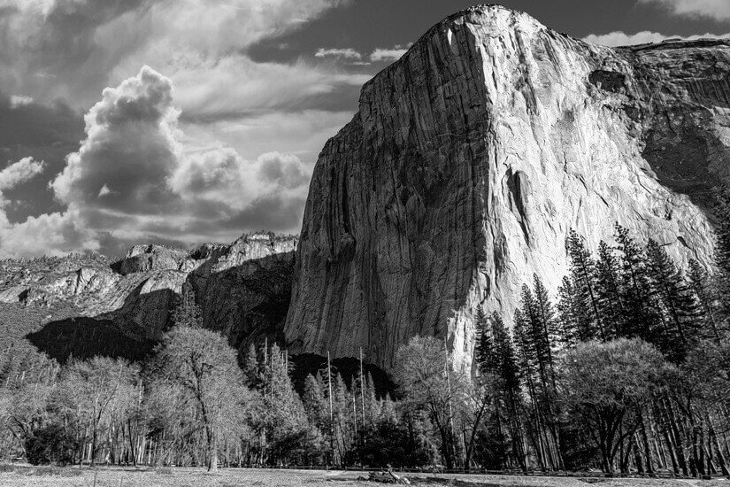
This southern entrance leads directly toward Wawona and the Mariposa Grove of giant sequoias before the road climbs toward the valley.
Highway 120 from the east, called Tioga Road once it enters the park, is the route that changes everything for visitors coming from Nevada, Reno, or anywhere east of the Sierra.
From Reno the drive is about 218 miles and runs five hours. The critical detail is that this route only operates from approximately late May or June through October, depending on snowpack.
It closes completely under winter conditions and does not reopen until the Sierra has cleared.
Anyone planning to drive in from the east, including travelers who have been exploring the Great Basin region, needs to verify current road status before assuming this option is available.
In winter, a Reno-to-Yosemite drive routes entirely around the Sierra through Sacramento, stretching the trip to 315 miles and five and a half hours.
Directions
The NPS is direct about this point, and it is worth taking seriously. GPS units frequently give inaccurate directions both to and within Yosemite. The park does not have a single address.
It covers mountain terrain where roads are complex, seasonal, and subject to closures that digital maps are slow to reflect. When a road sign contradicts a GPS instruction, the road sign is correct.
This is not a hypothetical concern. Visitors following GPS directions have ended up on unpaved roads, on roads closed for the season, and on routes that added hours to drives that should have been straightforward.
The practical answer is to download offline maps before entering the park, carry a paper map as backup, and plan routes using the NPS Yosemite maps page rather than relying solely on consumer navigation apps.
For travelers from Germany driving a rental car in California for the first time, this is worth flagging specifically.
American highway navigation feels familiar enough to manage, but mountain park roads operate differently from interstate driving, and the combination of unfamiliar terrain and unreliable GPS is a real planning gap worth closing before departure.
Fill your Tank Before Entry
Gas is not available in Yosemite Valley at all. That absence catches visitors who have driven into the valley on a low tank, expecting to find a station somewhere in the park’s most populated area, and found nothing.
Gas is available at Wawona, Crane Flat, and El Portal, all accessible 24 hours a day with a credit card, but those stations are not in the valley.
Anyone driving into Yosemite Valley should fill the tank before entering the park or fuel at one of those three locations on the way in.
For EV drivers, the park has installed charging stations that use J1772 connectors. The network is growing but not comprehensive, and relying on it without a plan is a risk.
Checking current charging locations through the Alternative Fuels Data Center before the trip, and identifying backup charging options in gateway towns, is the kind of preparation that separates a smooth visit from a stressful one.
This matters more as American and Canadian travelers increasingly make long national park road trips in electric vehicles.
Winter Chains Required
Chain controls on Yosemite roads can be enforced from around October through April with little or no advance notice. This applies not just to high-elevation roads but to any park road when conditions warrant it.
Being turned back at an entrance because you do not have chains in the car is a completely avoidable outcome that happens to a meaningful number of visitors every winter season.
Rental car drivers face a particular wrinkle here. Many rental agreements in California prohibit the installation of tire chains on the vehicle, or require specific chain types.
Checking rental terms before a winter trip is the kind of unglamorous pre-trip task that saves significant frustration.
Travelers who have read the best time to visit Yosemite guide will already understand that winter is a genuinely worthwhile season in the park, which makes getting this detail right matter more, not less.
Yosemite Experience
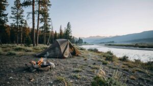
The roads into Yosemite, particularly the final approaches along Highway 140 through the Merced River canyon and along Highway 120 through the oak woodlands of the Sierra foothills, are among the more beautiful drives in California.
The Merced River runs alongside Highway 140 for much of the approach, and the transition from Central Valley flatness to canyon and granite happens gradually and then all at once as Arch Rock comes into view.
Planning the drive carefully is not just logistics. It is the decision to arrive in good condition, on the right road, at the right time of year, ready to actually be in the place rather than managing the consequences of something that could have been handled before you left home.