Big Bend National Park is in Far West Texas, along the Rio Grande where the river curves sharply south before turning back north, forming the bend that gives the park its name.
It sits about 100 miles south of Marathon and roughly 330 miles southeast of El Paso, in one of the most remote corners of the continental United States.
The entrance fee is $30 per vehicle for a seven-day pass, cash is not accepted anywhere in the park, and there are no reservations required to enter.
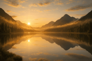
The park covers 801,163 acres of Chihuahuan Desert, mountain terrain, and river canyon, and it holds the distinction of having some of the darkest night skies of any national park in the lower 48 states.
Most people who visit Big Bend do so because they have heard it described as genuinely remote, and they are not disappointed. The nearest commercial airport is Midland International, about 230 miles to the north.
The isolation is not incidental to the experience. It is the experience.
How To Get There
Driving is the only practical way in. From the north, US Highway 385 runs south from Marathon directly to the Persimmon Gap entrance on the park’s northern boundary.
From the west, US Highway 90 connects to State Highway 118 and enters through the western side near Terlingua and Study Butte.
From the east, US 90 through Alpine feeds into Highway 385. There are no commercial shuttles or train services that reach the park.
Fuel is available at the Panther Junction area inside the park and at Castolon near the Rio Grande, but prices run higher than what you would pay in any nearby town.
Filling the tank before entering and carrying extra water is not optional advice in this part of Texas.
Summer temperatures regularly exceed 110 degrees Fahrenheit in the desert sections of the park, and cell service is essentially nonexistent once you leave the main highway corridors.
German visitors building an American Southwest itinerary sometimes underestimate the driving distances in West Texas.
Big Bend is not a park you can fold casually into a San Antonio or Austin trip without committing a full travel day in each direction. The isolation is real and the reward matches it, but the logistics require honest planning before you book flights.
About the Park
Big Bend divides into three distinct landscapes and understanding that division is the first step to planning a visit worth the drive.
The Chisos Mountains rise from the desert floor in the center of the park, topping out at Emory Peak at 7,832 feet.
The temperature at the basin is noticeably cooler than the desert floor, sometimes by 20 degrees, which makes the Chisos the most comfortable place in the park during summer.
The Chisos Mountains Lodge sits inside the basin and is the only lodging within park boundaries, making it the most logistically convenient base for a multi-day visit.
The desert sections spread across most of the park’s acreage and contain the iconic landscapes most people associate with Big Bend: sweeping plains of creosote and lechuguilla, volcanic rock formations, dry arroyos, and roadways that disappear into the horizon without another car in sight.
The Ross Maxwell Scenic Drive runs 30 miles through this terrain and is one of the better paved scenic drives in the national park system for sheer scale and solitude.
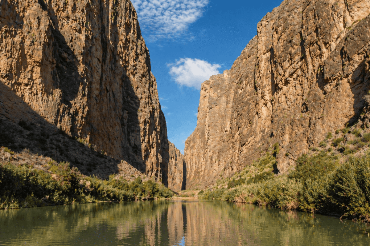
The Rio Grande corridor forms the southern boundary of the park along the US-Mexico border.
The river here has carved three major canyons into the limestone over millions of years.
Santa Elena Canyon is the most visited, with walls rising 1,500 feet above the river and a short trail that takes most visitors about an hour.
Boquillas Canyon to the east is longer and quieter.
The canyons are a different category of landscape from the desert above them, and the contrast between the two within the same park is one of the things that keeps Big Bend in a separate class from most desert destinations.
Activities
Big Bend has more than 150 miles of maintained trails ranging from short canyon walks to multi-day backcountry routes.
The Lost Mine Trail in the Chisos Basin is the standout day hike, running 4.8 miles round trip with 1,100 feet of elevation gain and views that extend into Mexico on a clear day.
The Emory Peak Trail extends the Lost Mine route to the park’s highest point and adds another two miles and 500 feet of climbing.
Both trails are best done early in the morning before heat and afternoon thunderstorms arrive in summer.
The park holds over 450 bird species, more than any other national park in the United States, which draws serious birders from across the country and from Europe.
The Colima warbler breeds nowhere in the US except the Chisos Mountains, which makes Big Bend an annual pilgrimage destination for birders who keep life lists.
Spring migration from March through May brings the highest diversity and the most intense birding activity.
River trips on the Rio Grande through the canyons are available through outfitters based in Terlingua, just outside the western park boundary.
A half-day float through Santa Elena Canyon is one of the more unusual experiences available anywhere in the Southwest.
No white water is involved in the standard float, making it accessible to visitors without paddling experience.

Costs
The $30 vehicle entrance fee covers seven consecutive days.
The America the Beautiful annual pass at $80 is honored and covers the entrance fee, making it the better financial choice for anyone visiting more than two or three parks in a year.
Big Bend also offers its own annual pass at $55 for those planning repeat visits.
Camping inside the park costs $16 per night at the three developed campgrounds: Rio Grande Village, Chisos Basin, and Cottonwood. Reservations are required and open six months in advance on recreation.gov.
Summer weekends in the Chisos Basin fill quickly. Backcountry camping requires a separate permit at $10 per night, obtainable online or at the visitor center.
The NPS conditions page for Big Bend is worth checking before any visit for road closures, river levels, and heat advisories.
Conditions in Far West Texas change faster than most visitors expect, and planning around current information rather than general expectations is the practical approach.
If you are building a broader Southwest road trip and want to understand how Big Bend fits alongside other parks across the region, the national park map by state on Tadexprof is a useful reference for sequencing the drive before committing to a route.
When to Visit
October through April is the comfortable window. Fall brings mild temperatures, good trail conditions, and the start of winter bird arrivals.
Spring is the most popular season for good reason: temperatures are ideal, wildflowers bloom across the desert floor after winter rains, and bird migration peaks.
March and April in particular draw the largest crowds Big Bend ever sees, which in relative terms is still modest compared to parks like Zion or the Grand Canyon.
Summer is genuinely difficult below the Chisos Basin. Hiking in the desert sections before 9 a.m. and after 5 p.m. is the only sensible approach between June and September, and even that requires more water than most hikers carry habitually.
The mountains stay manageable and the park empties out considerably, which suits visitors who prioritize solitude over comfort.
Big Bend does not meet visitors halfway. The road is long, the heat is serious, the services are sparse, and the nearest urgent care facility is an hour away on a good day.
What it offers in exchange is a version of the American West that has not been managed into accessibility, where the landscape operates on its own terms and the effort to reach it is part of what makes the place feel like it belongs to you when you finally arrive.