Arches National Park is in eastern Utah, five miles north of Moab on US Highway 191.
The entrance fee is $30 per vehicle for a seven-day pass, the park is open 24 hours a day year-round, and timed entry reservations are required during peak season from April through October.
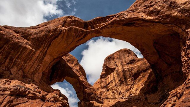
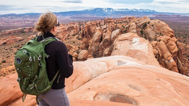
The park covers 76,519 acres of red sandstone desert on the Colorado Plateau and contains the highest concentration of natural stone arches anywhere on earth, more than 2,000 documented formations ranging from small windows in canyon walls to spans longer than a football field.
Salt Lake City is four hours to the northwest. Denver is five to six hours east. Most visitors arrive by car through Moab, which serves as the practical base for the park and the surrounding canyon country.
The arches are the draw, but understanding why they exist here and nowhere else in this concentration is what turns a drive-through into something worth remembering.
How the Arches Formed
The geology starts with salt. Millions of years ago, a shallow inland sea covered this part of the Colorado Plateau and left behind a thick layer of salt deposits as it evaporated.
Over time, thousands of feet of sediment buried that salt layer. Salt under pressure behaves plastically, shifting and buckling the rock above it into domes and ridges.
As the overlying sandstone cracked along these fault lines, water and ice worked into the fractures over millions of years, widening them into narrow fins of rock standing parallel to each other across the landscape.
The fins eroded further from the outside in, and where the rock was thinnest and the freeze-thaw cycle most relentless, the centers collapsed, leaving arches behind.
The process is still happening. Some arches are growing as erosion continues.
Others are collapsing. Wall Arch, once one of the park’s prominent formations, fell in 2008 without warning during the night. The landscape is not static, which is something the park does not let you forget.
How to Get There
Most visitors fly into Salt Lake City International Airport and drive south on I-15 before cutting east on US 6 and then south on US 191 into Moab. The drive runs about four hours.
Grand Junction Regional Airport in Colorado is a closer option at roughly 90 minutes and worth considering for visitors coming from the east. Canyonlands Field Airport just outside Moab handles limited regional flights for those who want to minimize driving.
A car is not optional. There is no shuttle service from Moab into the park, no train connection, and no practical way to experience the park without driving the main road and its spur routes.
German visitors accustomed to European rail infrastructure should factor this into planning early.
Renting in Salt Lake City or Grand Junction and driving in is the standard approach.
Timed Entry Planning
Arches introduced a timed entry reservation system to manage the volume of visitors the park was struggling to absorb at peak times.
From April through October, entering the park between 6 a.m. and 5 p.m. requires a reservation purchased in advance through recreation.gov. Reservations typically open three months ahead and go quickly for popular weekends.
Entering before 6 a.m. or after 5 p.m. does not require a reservation, which is relevant for anyone planning sunrise photography or a late-day hike.
The timed entry system is worth taking seriously. Showing up without a reservation during peak hours results in being turned away at the entrance station.
Building the reservation step into trip planning before booking accommodation is the practical sequence.
Attractions Activities
Delicate Arch is the formation most people have seen in photographs before they arrive.
It stands 52 feet tall on the lip of a slickrock bowl above the Colorado River canyon, and the hike to reach it covers three miles round trip with 480 feet of elevation gain across open sandstone with no shade.
The trail goes through the old Wolfe Ranch homestead, where a weathered log cabin dating to the 1880s still stands, and past a panel of Ute rock art.
The arch itself is best in the late afternoon when the rock glows red against the canyon background. Early morning is cooler and less crowded but the light falls differently.
Landscape Arch in the Devils Garden section of the park is one of the longest natural arches in the world, spanning roughly 290 feet.
The trail to reach it is flat and easy at 1.6 miles round trip.
Continuing past Landscape Arch into the Devils Garden primitive loop adds significant elevation and route-finding challenge and is best suited to hikers comfortable on uneven slickrock terrain.
The Windows Section near the center of the park groups several large arches within a short walk of the parking area, including North Window, South Window, and Turret Arch.
It is the most accessible concentration of major formations in the park and handles the most foot traffic as a result.
Arriving before 8 a.m. or after 4 p.m. changes the experience considerably.
Balanced Rock, a 3,600-ton boulder perched on an eroding pedestal near the main road, is one of those formations that photographs prepare you for and still manages to look improbable in person.
The short loop around its base takes about 15 minutes and is worth the stop.
Camping Fees
The $30 vehicle entrance fee is valid for seven days and covers all passengers.
The America the Beautiful annual pass at $80 waives the entrance fee at Arches and all other federal recreation lands for a year, which is the financially sensible choice for anyone visiting more than two or three parks on a trip.
If you are building a broader Utah itinerary that includes Zion and Bryce Canyon, the pass pays for itself before you reach Moab.
Our posts on Zion National Park and Bryce Canyon National Park cover both parks in detail if you are sequencing the drive through southern Utah.
The Devils Garden Campground, 18 miles from the entrance along the main park road, has 52 sites and fills daily from mid-March through October, often by mid-morning.
Reservations open six months in advance on recreation.gov and should be treated as a required planning step rather than an optional one.
There is no other camping inside the park.
For current road conditions, closures, and reservation information, the NPS Arches conditions page is updated regularly and worth checking in the days before any visit.
When to Go
Spring from late March through May is the most reliably comfortable window.
Temperatures sit between 60 and 80 degrees Fahrenheit, wildflowers push through the desert floor after winter moisture, and the light in the late afternoon turns the sandstone a color that exists nowhere else.
Fall from September through November runs a close second and tends to draw slightly thinner crowds.
Summer is the most popular season and the hardest one physically.
Temperatures regularly exceed 100 degrees Fahrenheit in July and August. Hiking before 9 a.m. and after 5 p.m. is the standard advice, and it is not precautionary.
Heat illness is a documented risk in the park during summer, and the open slickrock on trails like Delicate Arch offers no relief from direct sun.
Winter brings cold nights, occasional snow, and the emptiest trails of any season.
The arches in snow are genuinely striking, and a midwinter weekday in Devils Garden is one of the quieter experiences available in a park that spends most of the year crowded.
Arches sits at the center of a larger canyon country landscape that rewards visitors who give it more than a single rushed day.
The formations are extraordinary on their own terms, but the surrounding Colorado Plateau, the river canyons below, and the desert that connects it all to the parks further west and south is what turns a visit into something that stays with you.
One day is enough to see the highlights. Two days is enough to understand the place.